Can You Drive to Alaska? Detailed Routes & More
On my drives to Alaska from the USA (yes, I know Alaska is part of the USA. I'm talking about the contiguous United States) I've learned a lot. Had I known a few important things earlier, my first trip would have been easier, less stressful, and better overall.
Some things I probably could've found with more research, but others I couldn’t have. And besides, who wants to spend hours checking websites for one more detail — when they don't even know that they need to know it?
I've done the drive to Alaska from the USA eight times now. To make it easy for you, here's MY guide to driving to Alaska, which should fill all the gaps in information that other travel websites might have missed.
The start of the Alcan Highway
Can You Drive to Alaska?
Yes, you can drive to Alaska from anywhere in the continental United States or Canada. There are several routes you can take, and each has its own benefits and challenges. But driving to Alaska is a huge undertaking, and there's a lot that you need to know. While I highly recommend it, doing the research you need to beforehand is vital. And that's what this article is all about. My hope is that this article will answer all of your planning questions and provide a much needed update to our previous article about driving to Alaska.
Driving to Alaska Summary
In this guide, I’ll distill firsthand advice for summer (May–September) drives to Alaska, covering vehicle prep, pacing, food/water, sleep plans, communications, and border requirements (including firearm rules). I’ll outline three primary routes—Seattle via the Cassiar or Alcan and Great Falls via Alberta—with solitude notes, key fuel and stock-up points, and scenic highlights, plus standout detours to Prince Rupert, Skagway/Haines via the Klondike Highway, and Banff. Core logistics include stocking up in Prince George and Whitehorse, carrying ample water and at least one spare (full-size preferred), considering a gas can, preparing for long no-service stretches, and avoiding fully electric vehicles. The case for driving is both the journey—grand scenery and wildlife—and the destination, where Alaska’s size makes your own vehicle the most flexible, cost-effective way to explore.
Driving to Alaska Checklist and Considerations
Having a checklist is important when you’re driving up to Alaska. You should also consider things like the time of year you’re driving, the vehicle you’re taking, your food and water plan, how long you plan to take, your phone service plan, and what you want your sleeping situation to be. I'm going to go through all of those and more below.
Time Of Year - What time of year is your drive to Alaska?
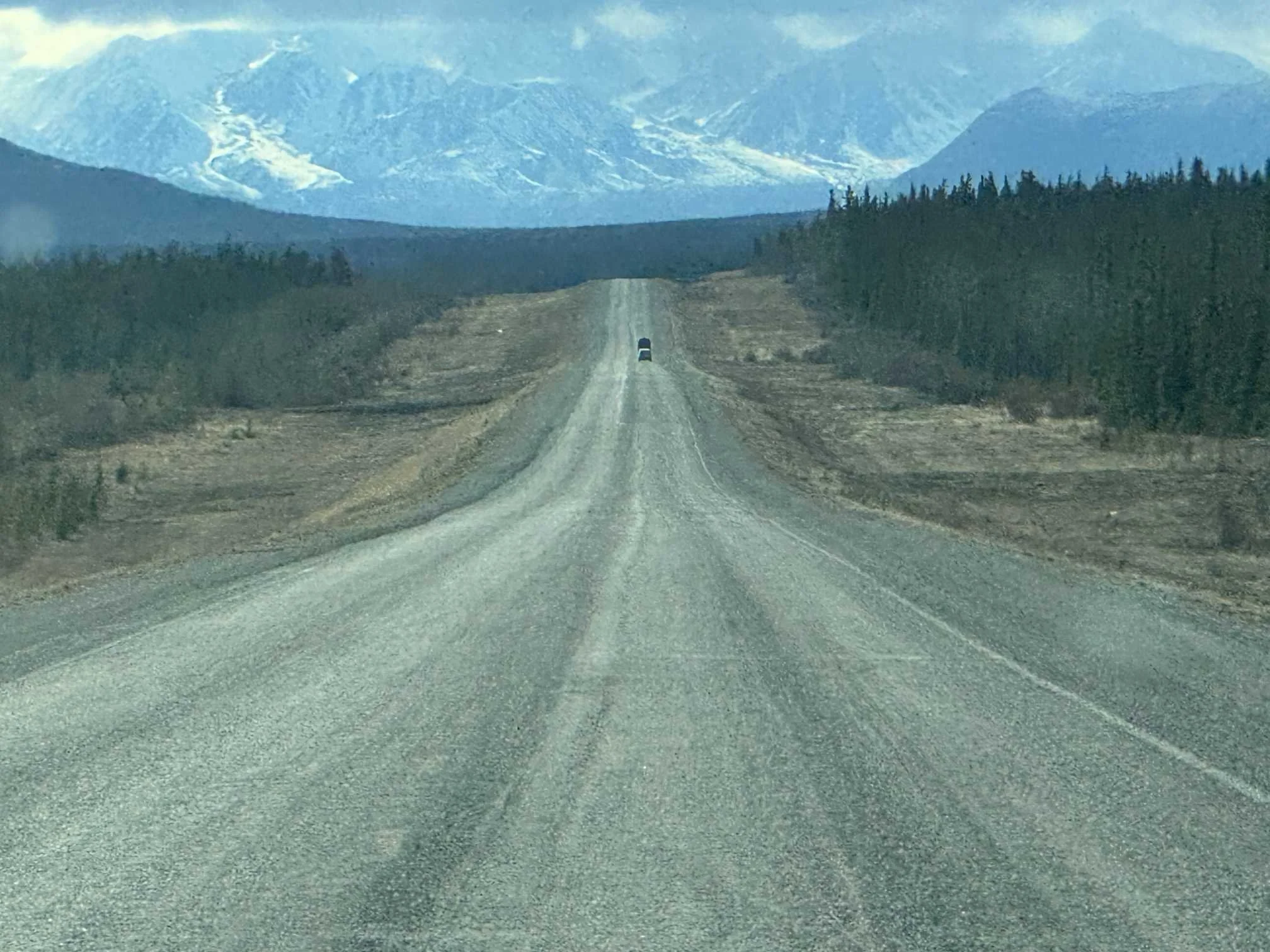
The Jack River in Alaska in May 2025
This guide will relate strictly to those traveling May through September, hereafter known as the Summer months or travel season. If you are driving to Alaska between October and April, you are almost certainly either a trucker or someone who already knows exactly what they're doing.
In early May and late September, be aware of temperatures and watch for ice and snow as you get further North. Good all-season tires are recommended if you're traveling in May or September, as are chains. Ice may show up on the roads if it drops below freezing in the Yukon and Alaska. Packed snow will be near impossible to find on the highways to Alaska in the travel season.
In relation to time of year, visitor volume is the only other relevant metric here. In the Summer months, multiple visiting groups are driving to and from Alaska daily. The number of travelers rises as time progresses toward July, then ebbs back down in late August and September. Basically, you may bump into more fellow travelers if you're driving up in late June/July/early August, but they're always going to be out there.
Pre-Trip Safety Check - Can you drive to Alaska with your vehicle?
Your car breaking down makes for a lousy day, especially if you're a thousand miles into Canada without cell service. While it's impossible to completely assure that your car won't break down in some way or another, you can mitigate risk. Getting your car checked out is the best due diligence you can do. What you're driving isn't nearly as important as whether or not it works.
You can easily call your local auto mechanic or tire shop and see if they do pre-trip checks, which should always be under $50. This is not a plug, but Les Schwab Tires does a completely free pre-trip safety check. The inspection is quick and cheap, but it can save you lots of stress and trouble.
A pre-trip check includes inspection of the tires, shocks, struts, battery, brakes, front end components and wheel alignment. Some easy tweaks can even save you gas mileage, such as an alignment or engine air filter replacement if you're in need. Saving on gas is pretty awesome when you're driving 2,000+ miles!
Checked up and ready to drive to Alaska!
Trip Duration - How long would you like your drive to Alaska to be?
Go into your trip with a rough image of what you want it to look like and you will really feel the benefits. Your drive can be done in two days or twenty.
The two to four day range is what I'd call the "speed record" range. You're probably excited about pushing yourself to race to the finish line, and you'll probably be rotating drivers and driving some in the dark. There will be no time to stop and check anything out, only necessary pit stops. Doable? Yes. Fun? ONLY if that's really your thing. My personal record is two and a half days (with two drivers) by the way. Can you drive to Alaska faster than I did? If you do, email me! I want to know!
The five to seven day range I would call the "expedited adventure" range. You'll likely be driving a good chunk every day, but you'll have time to stop for anything really cool. You can afford a whole day side adventure, but then you'll be back on the road with time to make up.
Anything past a week, and you're in the "it's about the journey" range. You likely have more than enough time to spare on your whole trip, and you should absolutely plan for it. Detours or longer routes to include places like Prince Rupert and Banff are in order, and you should absolutely take the time to really enjoy them. It will be tough to find the best detours on the go, though, so you should plan your detours beforehand.
Food - What will you eat on your drive?
Tim Hortons stop along the way are madatory.
Packing food for a drive to Alaska is more important than on other long road trips. While there are convenience stores, restaurants, and grocery stores along the way, quality and options may be lacking (particularly in the smaller towns and settlements).
Also, on the longer drive, typical road trip snacks like chips and pretzels are not going to feel great on the fifth day. A cooler with some real groceries like sandwich ingredients is great, along with a well-rounded variety of snacks. Fresh and dried fruit, jerky, and nuts are some excellent and easy snacks. Your big stops, such as Prince George and Whitehorse will have great grocery stores, but having a couple days worth of food is always a good plan.
Water - What's your hydration plan?
Having plenty of water is essential for ease and safety. If your car breaks down, you'll want more than enough water to last you until a good samaritan comes along in the most remote location possible.
You'll be able to refill your water bottles along the way, so no giant water tanks are needed. A water bottle and a two gallon jug per person would be my recommendation, but the exact amount is up to you.
Sleeping Situation- Where are you going to sleep on your drive to Alaska?
You should definitely know what your bedroom is going to look like on the road. Throughout Canada, it's legal to camp at pullouts. Alternatively, you can plan the legs of your journey around stopping at locations with Airbnb's or hotels every night.
Car camping or tent camping at pullouts is a good way to save money, but you'll need to bring all the gear you need to be comfortable. If I'm camping in a tent, I'd bring bear spray for safety (you never know, plus it works on any other creature that poses a threat).
I feel best camping at pullouts that are fully separate from any community or town, but where there's still a town close by --- preferably ahead of you. That way you avoid any unwanted attention and stay out of the way, but you have civilization and services the next morning if you need to plan your day.
Phone/Communication - How are you going to plan and communicate in Canada?
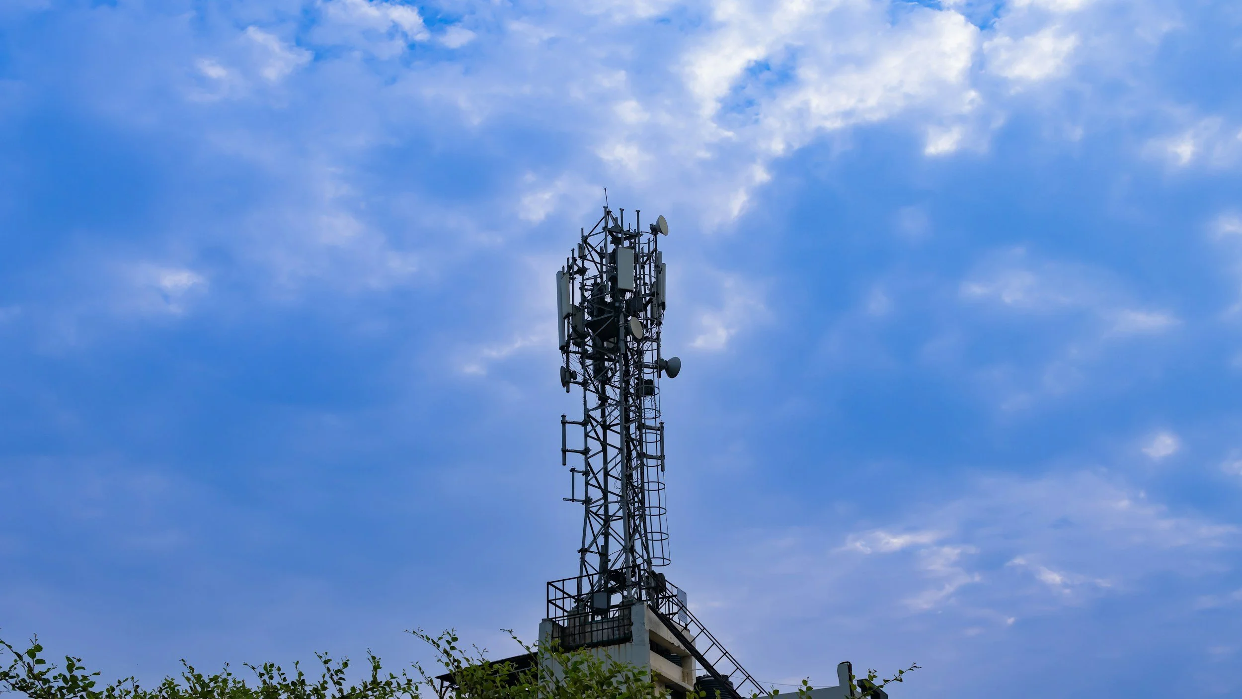
There aren’t many cell towers in many parts of the drive, especially the Cassiar. If you’re driving the Cassiar, expect up to 10 hours of driving without service.
Make sure you work with your service provider to get on a travel plan. You'll want as much service as you can get, and not at an absurd rate.
That said, there will still be big chunks of the trip with no service at all. A satellite GPS and communicator (Example: Garmin InReach with active subscription) is great for safety in those stretches.
Miscellaneous Essentials - What else do you need?
There are some things that you need to consider for your drive that don't fit well into any of the other categories here. I've put all of them below. While they're not as large as some of the other categories here, they're no less essential.
Bring a spare tire. At the very least a donut, but a full size spare is highly recommended.
You'll need current passports for every member of your party to get through the border.
Bringing a gas can is conditionally essential. I recommend it for peace of mind, but it's not essential if your vehicle has a full tank range over 250 miles (most do nowadays).
Driving a fully electric vehicle to Alaska is next to impossible. Don't do it.
Toiletries and comfortable clothing are important. These are things that are part of everyone's packing routine, but it bears mentioning. You'll be on the road for a few days to a few weeks, so you'll want to be prepared.
Don't bring any illegal substances or objects through the border. Prohibited firearms include automatic or converted automatic weapons, certain handguns including any whose barrel is less than 105 mm long, and certain military style weapons (even those designed for civilian use).
Non-restricted firearms include most ordinary hunting rifles and shotguns, though those will still require disclosure at the border. Restricted firearms mostly include handguns, but certain knives and pepper sprays are lumped into this group. In addition to disclosure, you will need to obtain an Authorization to Transport permit ahead of time. Failing to disclose any firearm will result in a fine and being turned around at the border.
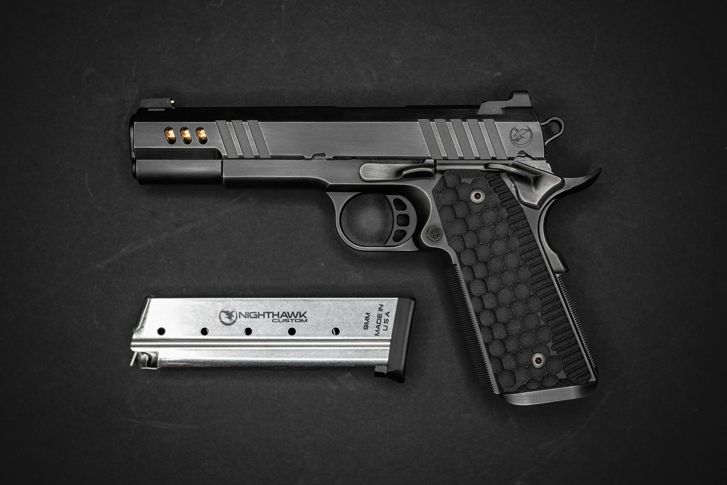
If you’re carrying a firearm across the border, make sure you know the laws. Many firearms are restricted or prohibited.
Routes to Alaska:
There are many routes you can take from the contiguous United States up to Alaska. In this section, I will lay out the significant stops, legs of the journey, detours, distances and travel times for the routes I've taken through Canada to and from Alaska.
The start of each route will be a hub in the Northern states, and they'll all end in Tok, Alaska (the junction between highways headed towards Anchorage and Fairbanks). Be sure to add the drive time and route from YOUR actual start to the Route start (and Route end to YOUR actual destination point).
Note: I have only taken a few routes through Canada, so there's a chance your route won't be included in this section. Sorry! I hope to travel more routes in the future and update this list, but I'm choosing not to include information on routes that I don't have firsthand knowledge of.
Opinion Based Solitude Scale: Different legs of these journeys will feel more or less solitary, both on the road and at gas/sleeping stops. I will therefore be highlighting the individual legs and potential stops — either "not solitary," "slightly lonely," or "I hope I don't get stuck here."
Drive Times: The times listed after the mile marker for each town are the driving time from the previous town. If you plan to pass through multiple towns without stopping (who doesn't?), just add the times together and mileage together until you get your perfect driving leg.
Route 1 - Seattle, WA to Tok, AK (Cassiar Highway) - 34 hr direct drive time / 1,945 miles
Notable City/Town Direct Passthroughs:
Seattle, WA, not solitary: Mile 0 (Start) — Home of the Seattle Seahawks, winners of Super Bowl LX.
Bellingham, WA, not solitary: Mile 89 (1 hr 32 min) — The final sizable US city on the route.
Sumas, WA, not solitary: Mile 111 (40 min) — Border crossing town. Gassing up before the border is recommended for savings.
SUMAS BORDER CROSSING
Abbotsford, BC, not solitary: Mile 116 (20 min) — First Canadian city on the route, a bit East of Vancouver.
Hope, BC, not solitary: Mile 163 (55 min) — Starting point for the optional LARGE detour to Banff. There is also gas, lodging, and places for food in Hope.
The Fraser River near Boston Bar, BC in late April 2025.
Boston Bar, BC, slightly lonely: Mile 203 (45 min) — Boston Bar is very small, but it does have a gas station. Located along the Fraser River Canyon, this section is actually one of the coolest parts of the drive.
Cache Creek, BC, slightly lonely: Mile 283 (1 hr 29 min) — While pretty small, Cache Creek has multiple lodging options, fast food and convenience stores, and gas stations.
Williams Lake, BC, slightly lonely: Mile 409 (2 hr 6 min) — Williams Lake is bigger than Cache Creek, and has the full range of amenities you'd expect from a small town. Grocery stores, gas stations, lodging, auto shops, and more.
Prince George, BC, not solitary: Mile 554 (2 hr 35 min) — Prince George is the last true city before Whitehorse in the Yukon: Stock up on anything you need! If you have any repairs or miscellaneous purchases to make, now's the time. Route 1 and 2 part ways leaving Prince George.
Vanderhoof, BC, not solitary: Mile 616 (1 hr 6 min) — A small town an hour out from Prince George, Vanderhoof has gas, food, and lodging options. This won't matter to most, as you probably just restocked everything in Prince George.
Houston, BC, slightly lonely: Mile 745 (2 hr 15 min) — Houston is roughly the size of Vanderhoof, and has all the same traveling essentials such as food, gas, and lodging. It's just further past Prince George.
Kitwanga, BC, I hope I don't get stuck here: Mile 856 (1 hr 57 min) — You may start to really feel the isolation around Kitwanga. It does have a population of a few hundred, and there's gas and a general store.
Meziadin Junction, BC, I hope I don't get stuck here: Mile 947 (3 hr 39 min) — Be sure to gas up at the Petro Canada in Meziadin Junction. Not much else here!
Iskut, BC, I hope I don't get stuck here: Mile 1,101 (3 hr 3 min) — Not a whole lot in Iskut, either. There's a gas station and convenience store, though!
Dease Lake, BC, I hope I don't get stuck here: Mile 1,153 (1 hr 3 min) — There's gas and lodging options in Dease Lake. That's about it!
Nugget City, YT, I hope I don't get stuck here: Mile 1,299 (3 hr 7 min) — A gas station and RV park are the only things at this junction. Route 1 and 2 meet back up for the rest of the journey here, though.
Teslin, YT, slightly lonely: Mile 1,447 (2 hr 21 min) — Though also tiny in population, for me Teslin feels like the ending to the highest degree of solitude on this drive. It has gas, lodging, and a general store.
Whitehorse, YT, not solitary: Mile 1,557 (1 hr 52 min) — Last real city of route (pop. 28,225). You may wish to stock up on anything needed for the rest of your trip, or hit the Real Canadian Superstore for some cheap deals on supplies.
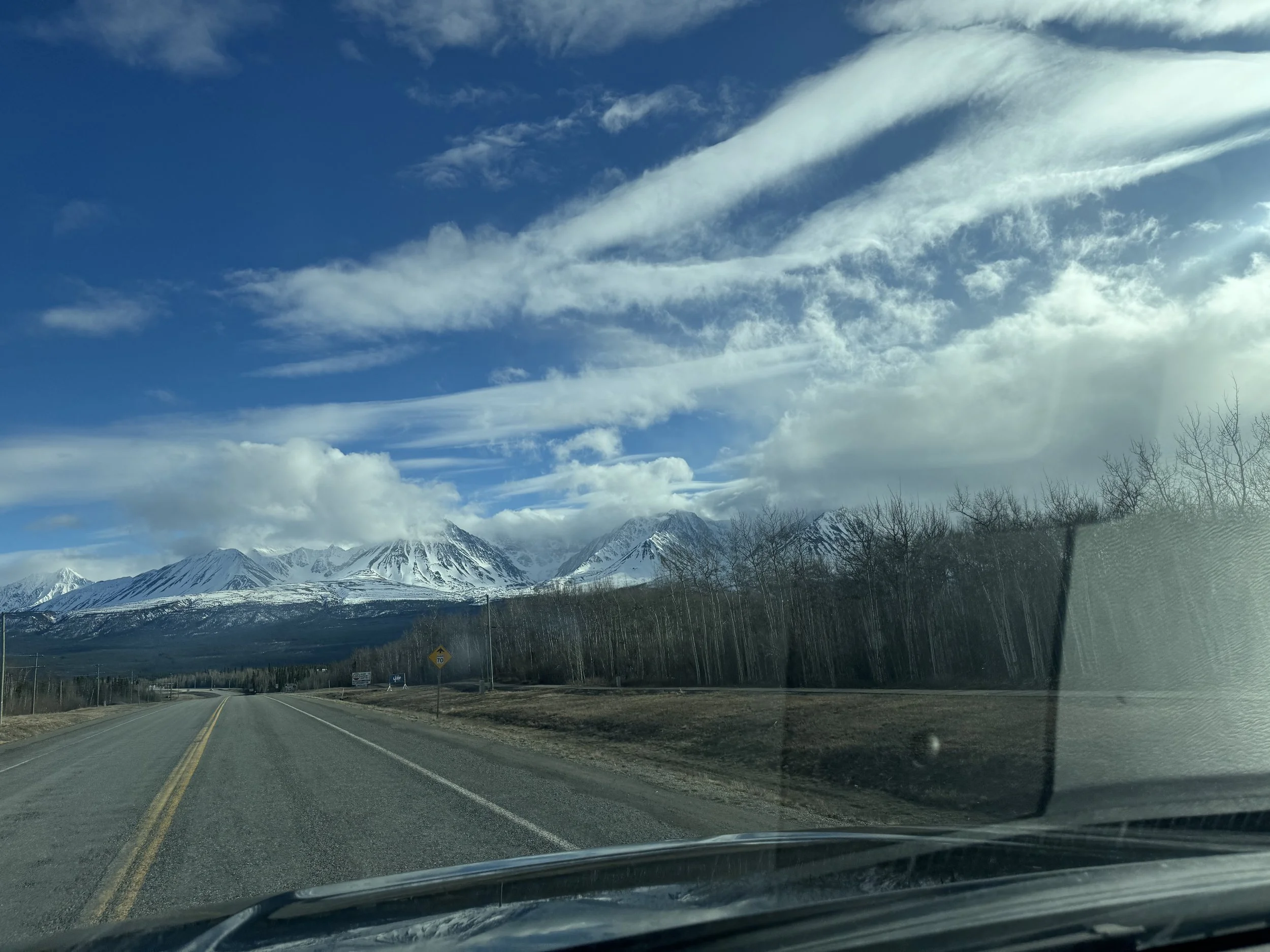
Haines Junction, YT, not solitary: Mile 1,652 (1 hr 38 min) — Haines Junction has gas and lodging. I like Haines Junction, because it is the start of a beautiful section of the drive, from here through Destruction Bay.
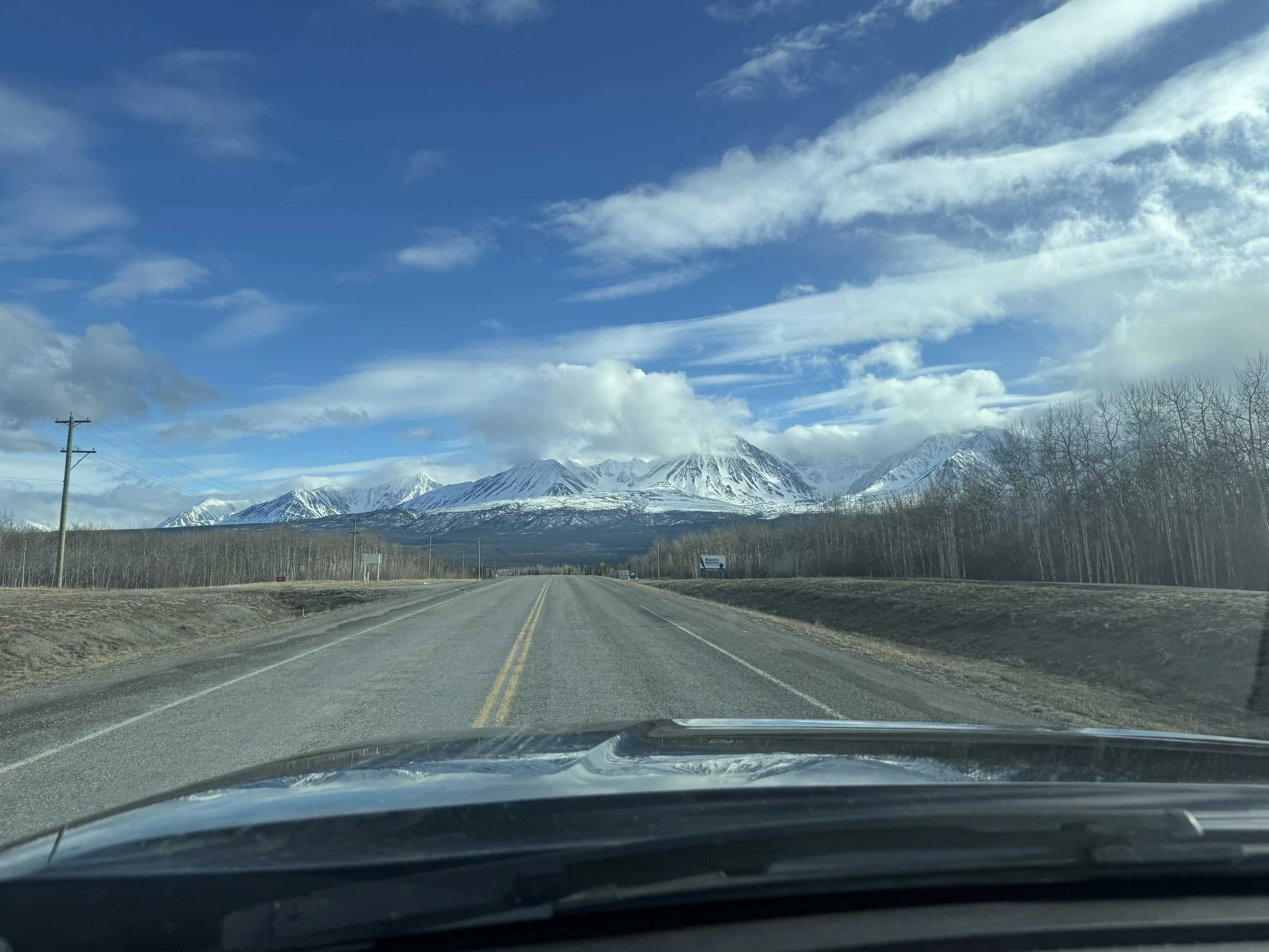
Driving into Haines Junction, May 2025
Destruction Bay, YT, slightly lonely: Mile 1,718 (1 hr 10 min) — There is gas and lodging around Destruction Bay. This is also a great spot for a mini detour or excursion. It's a really beautiful area with lots of wildlife, and there are loads of viewpoints and short hikes to take advantage of.
Beaver Creek, YT, slightly lonely: Mile 1,833 (2 hr 5 min) — There are gas and lodging options at the last Canadian town of this route. The gas can be unreliable, though.
ALCAN BORDER CROSSING
Northway Junction, AK, slightly lonely: Mile 1,894 (1 hr 18 min) — A small junction settlement, the Northway Junction has gas stations, fueling you to finish strong to Tok.
Tok, AK, not solitary: Mile 1,942 (54 min) — Tok has a grocery store (Three Bears!), gas, and lodging options. Depart from here to your desired Alaska destination!
Route 2 - Seattle, WA to Tok, AK (Alcan Highway) - 37 hr direct drive time
Notable City/Town Direct Passthroughs:
Seattle, WA, not solitary: Mile 0 (Start) — Home of the Seattle Seahawks.
Bellingham, WA, not solitary: Mile 89 (1 hr 32 min) — The last sizable US city on the route.
Sumas, WA, not solitary: Mile 111 (40 min) — Border crossing town. Gassing up before the border is recommended for savings.
SUMAS BORDER CROSSING
Abbotsford, BC, not solitary: Mile 116 (20 min) — First Canadian city on the route, a bit East of Vancouver.
Hope, BC, not solitary: Mile 163 (55 min) — Starting point for the optional LARGE detour to Banff. There is also gas, lodging, and places for food in Hope.
Boston Bar, BC, slightly lonely: Mile 203 (45 min) — Boston Bar is very small, but it does have a gas station. Located along the Fraser River Canyon, this section is actually one of the coolest parts of the drive.
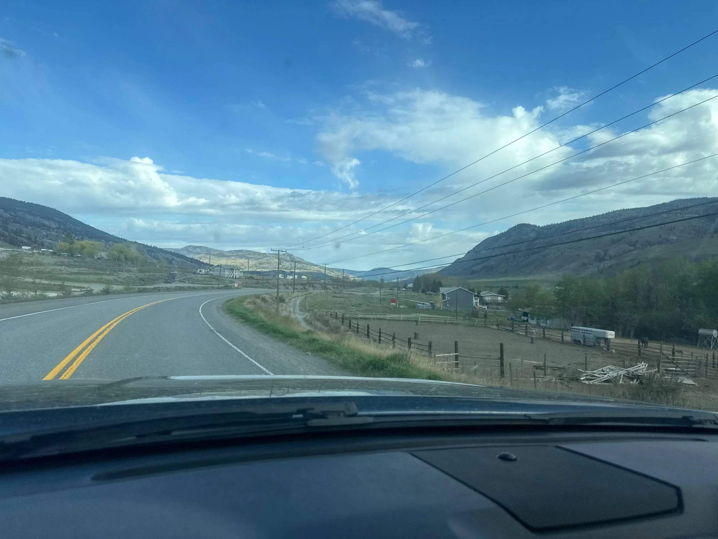
Farmland near Boston Bar, British Columbia
Cache Creek, BC, slightly lonely: Mile 283 (1 hr 29 min) — While pretty small, Cache Creek has multiple lodging options, fast food and convenience stores, and gas stations.
Williams Lake, BC, slightly lonely: Mile 409 (2 hr 6 min) — Williams Lake is bigger than Cache Creek, and has the full range of amenities you'd expect from a small town. Grocery stores, gas stations, lodging, auto shops, and more.
Prince George, BC, not solitary: Mile 554 (2 hr 35 min) — Prince George is the final CITY city until Whitehorse in the Yukon: Stock up on anything needed! If you have any repairs or miscellaneous purchases to make, now's the time. Route 1 and 2 part ways leaving Prince George.
Mcleod Lake, BC, slightly lonely: Mile 637 (1 hr 33 min) — A very small community, Mcleod lake has a gas station to fuel up at.
Chetwynd, BC, slightly lonely: Mile 745 (1 hr 43 min) — Chetwynd is bigger than Mcleod lake, but still very small. It does have food, lodging, and gas stations readily available, however.
Fort St. John, BC, slightly lonely: Mile 829 (1 hr 35 min) — Fort Saint John is a small town, yet still much bigger than Chetwynd. It'll have any travel essentials you need to restock on, but at elevated small town prices.
Wonowon, BC, I hope I don't get stuck here: Mile 882 (1 hr) — One of the most isolated sections of this route, Wonowon has gas stations and a couple other amenities.
Fort Nelson, BC, slightly lonely: Mile 1,064 (2 hr 57 min) — Fort Nelson has a surprising amount of lodging, stores, and gas stations for a small town. It definitely feels bigger than its population.
Toad River, BC, slightly lonely: Mile 1,181 (2 hr 16 min) — I have a strange fondness for Toad River, probably because it had a much needed gas station that rescued me on my first ever drive up. There's not much in Toad River, but it's a nice little spot.
Watson Lake, YT, slightly lonely: Mile 1,383 (3 hr 40 min) — Also a small town, Watson Lake has lodging, food, and gas.
Nugget City, YT, I hope I don't get stuck here: Mile 1,397 (17 min) — Pretty much just a gas station and RV park are located at this junction. Route 1 and 2 meet back up for the rest of the journey here, though.
Teslin, YT, slightly lonely: Mile 1,544 (2 hr 21 min) — Though also tiny in population, for me Teslin feels like the ending to the highest degree of solitude on this drive. It has gas, lodging, and a general store.
Whitehorse, YT, not solitary: Mile 1,655 (1 hr 52 min) — Final CITY of route (pop. 28,225). You may wish to stock up on anything needed for the rest of your trip, or hit a real supermarket for some cheap deals on supplies.
Haines Junction, YT, not solitary: Mile 1,749 (1 hr 38 min) — Haines Junction has gas and lodging. I like Haines Junction, because it is the start of a beautiful section of the drive, from here through Destruction Bay.
Destruction Bay, YT, slightly lonely: Mile 1,815 (1 hr 10 min) — There is gas and lodging around Destruction Bay. This is also a great spot for a mini detour or excursion. It's a really beautiful area with lots of wildlife, and there are lots of viewpoints and short hikes to take advantage of.
Grainy photo, but beautiful drive to Alaska.
Beaver Creek, YT, slightly lonely: Mile 1,930 (2 hr 5 min) — There are gas and lodging options at the last Canadian town of this route.
ALCAN BORDER CROSSING
Northway Junction, AK, slightly lonely: Mile 1,991 (1 hr 18 min) — A small junction settlement, the Northway Junction has gas stations, fueling you to finish strong to Tok.
Tok, AK, not solitary: Mile 2,040 (54 min) — Tok has a grocery store (Three Bears!), gas, and lodging options. Depart from here to your desired Alaska destination!
Route 3 - Great Falls, MT to Tok, AK - 36 hr direct drive time / 2,116 miles
Notable City/Town Direct Passthroughs:
Great Falls, MT, not solitary: Mile 0 (Start) — Truly, a town in Montana.
Shelby, MT, not solitary: Mile 85 (1 hr 14 min) — Truly, another town in Montana. Gas up before the border.
Sweet Grass, MT, not solitary: Mile 119 (30 min) — Sweet Grass is a border settlement, not much here besides customs.
SWEET GRASS BORDER CROSSING
Lethbridge, AB, not solitary: Mile 184 (1 hr 12 min) — First notable Canadian town.
Calgary, AB, not solitary: Mile 315 (2 hr 10 min) — Calgary is the start of the Banff Detour, and it's also home to the Calgary Stampede in early July. Calgary and Edmonton are the two big cities on this route to Alaska
Edmonton, AB, not solitary: Mile 496 (3 hr 4 min) — The other big city, a couple hours past Calgary. You'll start heading West from Edmonton.
Whitecourt, A, slightly lonely: Mile 606 (2 hr 1 min) — Whitecourt is a small town, but it does have food, gas, and lodging options available.
Grand Prairie, AB, not solitary: Mile 779 (2 hr 37 min) — Grand Prairie is a midsized town that has anything you might need as you continue your travels.
Fort St. John, BC, slightly lonely: Mile 905 (2 hr 25 min) — Fort Saint John is a small town. It's also where Route 2 and Route 3 meet. It'll have any travel essentials you need to restock on, but at elevated small town prices.
Wonowon, BC, I hope I don't get stuck here: Mile 958 (1 hr) — One of the most isolated sections of this route, Wonowon has gas stations and a couple other amenities.
Fort Nelson, BC, slightly lonely: Mile 1,140 (2 hr 57 min) — Fort Nelson has a surprising amount of lodging, stores, and gas stations for a small town. It definitely feels bigger than its population.
Toad River, BC, slightly lonely: Mile 1,257 (2 hr 16 min) — I have a strange fondness for Toad River, probably because it had a much needed gas station that rescued me on my first ever drive up. There's really not much in Toad River, but it's a nice little spot.
Watson Lake, YT, slightly lonely: Mile 1,458 (3 hr 40 min) — Also a small town, Watson Lake has lodging, food, and gas.
Nugget City, YT, I hope I don't get stuck here: Mile 1,472 (17 min) — A gas station and RV park are the only things at this junction. Route 1 meets with 2 and 3 for the rest of the journey here, though.
Teslin, YT, slightly lonely: Mile 1,620 (2 hr 21 min) — Though also tiny in population, for me Teslin feels like the ending to the highest degree of solitude on this drive. It has gas, lodging, and a general store.
Whitehorse, YT, not solitary: Mile 1,730 (1 hr 52 min) — Final CITY of route (pop. 28,225). You may wish to stock up on anything needed for the rest of your trip, or hit a real supermarket for some cheap deals on supplies.
Haines Junction, YT, not solitary: Mile 1,825 (1 hr 38 min) — Haines Junction has gas and lodging. I like Haines Junction, because it is the start of a beautiful section of the drive, from here through Destruction Bay.
Coming into Haines Junction. This is where the drive to Alaska starts getting really beautiful!
Destruction Bay, YT, slightly lonely: Mile 1,891 (1 hr 10 min) — There is gas and lodging around Destruction Bay. This is also a great spot for a mini detour or excursion. It's a really beautiful area with lots of wildlife, and there are lots of viewpoints and short hikes to take advantage of.
Beaver Creek, YT, slightly lonely: Mile 2,007 (2 hr 5 min) — There are gas and lodging options at the last Canadian town of this route.
ALCAN BORDER CROSSING
Northway Junction, AK, slightly lonely: Mile 2,067 (1 hr 18 min) — A small junction settlement, the Northway Junction has gas stations, fueling you to finish strong to Tok.
Tok, AK, not solitary: Mile 2,116 (54 min) — Tok has a grocery store (Three Bears!), gas, and lodging options. Depart from here to your desired Alaska destination!
Worthwhile Detours:
There are a few notable and worthwhile detours that can be made from these routes. I go through all of the best detours on your way up to Alaska below.
The Prince Rupert Detour:
A detour to Prince Rupert is great for wildlife viewing, fishing, hiking and more.
From Route 1 (Cassiar), continue West on Trans-Canada Highway 16 rather than turning onto Highway 37 in Kitwanga. Continue for 148 miles and arrive at Prince Rupert, BC. This detour adds a total of 5 hrs and 20 minutes drive time total.
The Khutzeymateen Grizzly Bear Sanctuary, accessible via boat or plane, is less than 30 miles from Prince Rupert. The bears are visible from the water's edge and feed in the estuary between mid-May and late July. There is also ample opportunity for whale watching and bird watching.
Prince Rupert is a fishing town, and chartering a fishing trip is an excellent excursion. The waters around Prince Rupert are home to halibut, many types of salmon, dungeness crab and more.
Prince Rupert is located in a beautiful natural area that has loads of hiking and outdoor adventure spots. Hiking and exploring is a sandbox and everyone likes a different experience, so I recommend doing your own research for that.
The Klondike Highway Detour:
Like Prince Rupert, the Skagway/Haines area offers an array of outdoor pursuits.
From Whitehorse, travel south for 110 miles until you reach Skagway. You can go further, taking the Marine Highway all the way to Haines, but that does take some boat travel.
Fishing, hiking, and wildlife viewing are all top-notch activities in the area. You can book guided tours for most of that, and there are more guided activities you can participate in as well.
There are water sports, ranging from casual to extreme, to check out in the Haines area. From a few hour long sea kayaking trip to multi day rafting trips on nearby glacially fed rivers, you can rest assured that your need for adventure will be sated here.
Flying tours, walking tours, historical sites, and museums may also be worth your time while on this detour!
The Banff Detour:
Banff is beautiful!
This is the big one. Banff is probably the most known and popular natural area in Canada, and it's gonna be the favorite detour of many vacationers.
Banff is the least out of the way from route 3, but it can be done pretty easily from any route. From Hope, BC, on routes 1 and 2, you'll take Highway 5 northeast rather than going straight north toward Boston Bar. When you reach Kamloops, you'll continue east on Highway 1, and around six hours later you'll arrive in Banff National Park.
From Calgary on Route 3, head straight West on Highway 1 for 114 miles, and you'll reach Banff National Park.
Leaving Banff and heading up to Alaska is a little different. You can directly retrace your steps to the route you were taking if you have a specific reason for it; otherwise, you should follow this route:
Take Highway 93 north from Banff to the small town of Jasper. From there, take Highway 16 a short ways, then turn north onto Highway 40 the rest of the way up to Grand Prairie. After reaching Grand Prairie, you'll just go the rest of the way on Route 3!
Banff is the crown jewel of Canada in many ways. It was Canada's first National Park, and the beauty and diversity of landscape is unmatched!
Located at the northern end of the Rocky Mountains, Banff and Lake Louise are a bucket list location for those invested in the outdoors. Get active and try a variety of kayaking, hiking, sightseeing, hot springs and more!
Why You Should Drive to Alaska!
Obviously, driving to Alaska is a huge endeavor, and flying is generally much easier. However, I find doing the drive to be the best way to travel up to the 49th state. The reasons for this can be split into two categories: The Journey, and The Destination.
The Journey talks about the positives of the drive itself. Wildlife, adventure, landscapes, and more are all parts of The Journey. The Destination focuses on why it'll be nice to have your car once you're up in Alaska.
The Journey (The Drive)
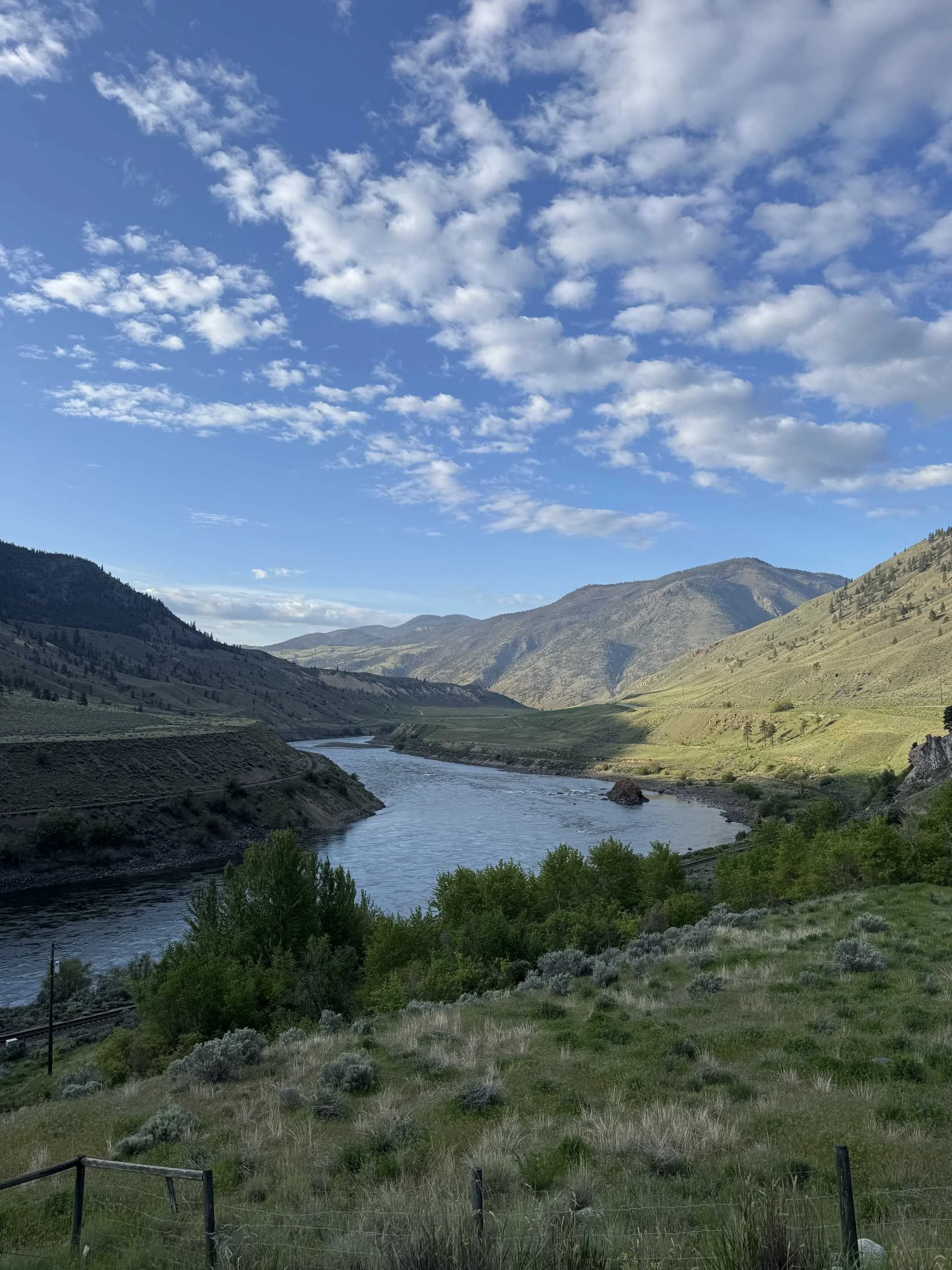
Whatever route you take, the drive is going to be gorgeous. The rolling hills and forests across British Columbia, Alberta, and Saskatchewan are limitless and hypnotizing. You'll have to be careful if you're the driver! Any detour or side adventure you take will be its own little nugget of awesomeness along the way.
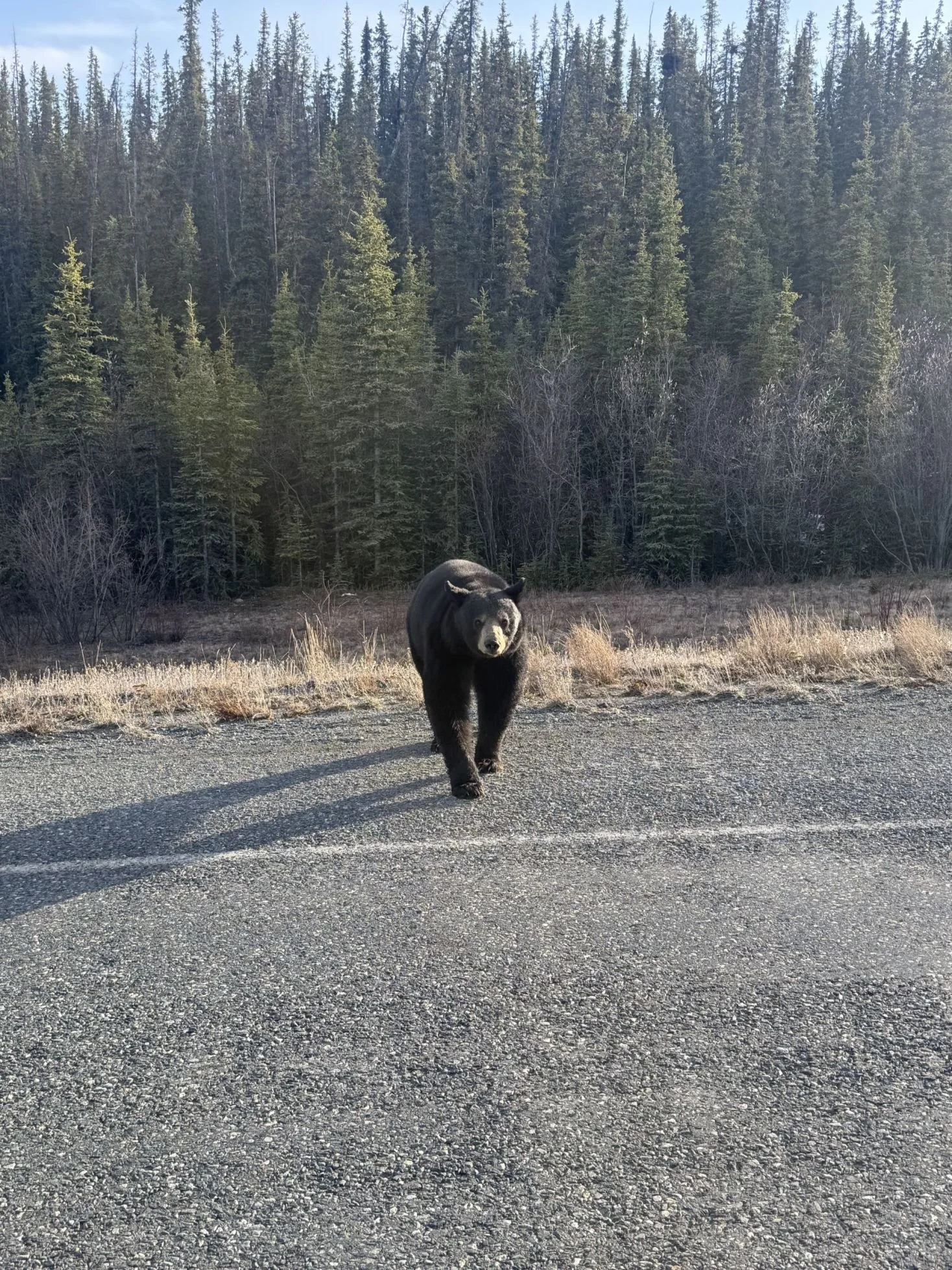
A black bear walking up to my car in one of the remote sections of the Cassiar Highway
The drive truly becomes top tier when you make it up to the Yukon and Alaska. Wild animal sightings will become much more frequent, and spectacular views will be commonplace. You may spot herds of bison along the road, black or brown bears, moose, Dall sheep and more! This should go without saying, but exercise caution when driving around wild critters, and definitely don't get out of your vehicle to approach them. If you drive up in late April or early May, you'll pass by loads of frozen lakes and snowy peaks as well.
Overall, when traveling to Alaska, you'll want your trip to be grand and adventurous. Driving all the way through Canada and across North America is a grand journey that becomes an integral part of your whole experience. Not only is it gorgeous, but it's a true achievement as well. Believe it or not, many more people take a plane or cruise ship to Alaska than drive there. I have found very few people outside of my circle of lunatic adventurers who have actually driven to Alaska. Most haven't even driven half as far to a destination one tenth as remote. It will be a lasting memory for all who embark on the journey.
The Destination (Alaska)
The Destination? You may think, whether you arrive by boat, plane, or car, the destination is the same... WRONG. Alaska is a massive state. It's roughly the size of France, Germany, Sweden, and Norway combined. There are less than 20 countries in the world that are larger than the state of Alaska. This makes a vehicle the most valuable tool imaginable for a trip to Alaska.
This doesn't necessarily mean you NEED to drive all the way up to get the most out of Alaska. You can always rent a car to get around, and heck, getting the most out of Alaska may just mean a fully planned cruise itinerary to you. There's nothing wrong with either of those options, so I'll just speak to why I personally believe having your own vehicle is the best way to go.
For one thing, renting a car is expensive and requires some planning. There may be restrictions based on availability, what makes and models are available, where you are able to pick up and drop off said vehicle, and length of rental.
There will be certain dirt or gravel roads that may lead to awesome destinations that the rental company doesn't want you driving on. The Denali Highway, for instance, is an amazing road to drive, with many great views of Denali, Mount Deborah, and other beautiful peaks. However, almost all of the road is gravel with many potholes to dodge. Rental car companies don't like that.
With your own vehicle, you can do anything, and the limits are what YOU feel comfortable doing. You can customize it however you'd like for the trip, and you will already know all of its quirks and features. With all that said, buckle in, and have a safe journey!
DISCLAIMER:
The views and opinions expressed in this article are solely those of the author, Sam Collier, and do not reflect the official policy or position of any organization, entity, or other contributors associated with this publication.
While every effort has been made to ensure the information provided is accurate and up-to-date, the author and publisher accept no responsibility or liability for any errors, omissions, or consequences arising from the use of this information. Readers are encouraged to verify all details independently before planning or undertaking their journey.
Traveling to Alaska by road can involve inherent risks, including but not limited to adverse weather conditions, wildlife encounters, road hazards, and vehicle challenges. Readers are strongly encouraged to conduct their own research, assess their personal preparedness, and seek specific and personalized guidance where necessary before embarking on such a journey.
Q&A Section
Question: When is the best time to drive to Alaska, and what weather and traffic should I expect?
Short answer: This guide focuses on May through September. Early May and late September can still bring freezing temps in the Yukon and Alaska, so watch for ice and snow. Good all-season tires are recommended for May or September, and carrying chains is wise. During summer travel season, packed snow on the highways is nearly impossible to find. Expect traveler volume to build toward July, peak in late June/July/early August, then taper off in late August and September — you'll see more fellow road-trippers mid-summer, but you won't be alone at any point in the season.
Question: How long should I plan for the drive to Alaska, and what does each pace feel like?
Short answer:
2-4 days ("speed record"): You'll rotate drivers, likely drive some in the dark, and make only essential stops. It's doable but not relaxing — choose this only if pushing hard is your thing.
5-7 days ("expedited adventure"): You'll drive a solid amount daily but still have time for quick stops and even a full-day side trip before getting back on schedule.
8+ days ("it's about the journey"): Build in detours (e.g., Prince Rupert, Banff) and slower segments to enjoy scenery and side adventures. Plan detours ahead of time; finding the best ones on the fly can be tough.
Question: How should I handle essentials like food, water, and communication on this trip?
Short answer:
Food: Options can be limited or pricey in smaller towns. Bring a cooler with real groceries (sandwich fixings) and varied snacks (fresh/dried fruit, jerky, nuts). Stock up in larger hubs like Prince George and Whitehorse, and keep a couple days' worth of food on hand.
Water: Carry plenty for comfort and safety if you break down. You can refill along the way. A simple setup is one water bottle plus a two-gallon jug per person.
Communication: Add a travel plan with your carrier, but expect long no-service stretches. A satellite GPS/communicator (e.g., Garmin InReach with an active subscription) adds a good safety margin.
Pro tip: Get a pre-trip safety check for your vehicle (often under $50; Les Schwab offers a free one). It covers tires, shocks/struts, battery, brakes, front-end components, and alignment. Small fixes (like alignment or a new engine air filter) can improve mileage on a 2,000+ mile run.
Question: What documents and rules do I need to know for the border — especially if traveling with firearms?
Short answer:
Bring current passports for everyone in your party.
Don't bring illegal substances or prohibited items.
Prohibited firearms include automatic or converted-automatic weapons, certain handguns (e.g., barrel less than 105 mm), and certain military-style weapons (even those marketed for civilian use).
Non-restricted firearms (most hunting rifles/shotguns) must be disclosed at the border.
Restricted firearms (mostly handguns; certain knives and pepper sprays are also treated this way) require disclosure plus an Authorization to Transport permit obtained ahead of time.
Failing to disclose any firearm leads to a fine and being turned around at the border.
Also wise: carry a spare tire (full-size preferred). A gas can is optional if your vehicle's full-tank range exceeds ~250 miles. Driving a fully electric vehicle to Alaska is as next to impossible — don't do it.
Question: Which route should I take, and what detours are worth adding?
Short answer:
Route 1 (Seattle → Tok via Cassiar Highway; ~34 hours/1,945 miles): More solitude between Kitwanga and Teslin; sparse services but reliable gas stops at places like Meziadin Junction, Iskut, and Dease Lake. Stock up in Prince George and, later, Whitehorse. The stretch from Haines Junction through Destruction Bay is particularly beautiful.
Route 2 (Seattle → Tok via the Alcan; ~37 hours): More towns and services (Chetwynd, Fort St. John, Fort Nelson, Toad River, Watson Lake). Joins Route 1 near Nugget City and follows the same finish through Whitehorse, Haines Junction, and Destruction Bay.
Route 3 (Great Falls, MT → Tok; ~36 hours/2,116 miles): Passes through Calgary and Edmonton, then heads west to meet the Alcan near Fort St. John. Best for easily adding Banff. Detours:
Prince Rupert (from Route 1, stay on Hwy 16): Adds ~5 hours 20 minutes total. Great for wildlife viewing (Khutzeymateen Grizzly Bear Sanctuary mid-May to late July), fishing charters (halibut, salmon, Dungeness crab), and hiking.
Klondike Highway to Skagway/Haines (from Whitehorse): 110 miles to Skagway; you can continue by Marine Highway to Haines. Top-notch fishing, hiking, wildlife viewing, water sports (sea kayaking to multi-day rafting), and guided tours/museums.
Banff: From Routes 1/2, go via Hope → Hwy 5 → Kamloops → Hwy 1 to Banff; from Route 3, it's 114 miles west from Calgary. To continue north, take Hwy 93 to Jasper, a short stretch of Hwy 16, then north on Hwy 40 to Grand Prairie and rejoin Route 3. Expect classic Rockies scenery and activities like hiking, kayaking, sightseeing, and hot springs.
Question: Is it really legal to camp at highway pullouts in Canada, and how can I do it safely?
Short answer: Yes, camping at pullouts is legal across much of Canada. To do it comfortably and safely, bring the gear you need (car or tent camping both work) and carry bear spray if you're tent camping. Choose pullouts that are away from towns to avoid unwanted attention, but try to have a town ahead of you for morning services.
Question: Where should I plan to stock up on food and fuel, and are there any "must-fill" stops?
Short answer: Stock up on big items and groceries in larger hubs: Prince George (last true city before the Yukon) and later Whitehorse (final city on the way to Tok). Gas is more frequent on the Alcan (Chetwynd, Fort St. John, Fort Nelson, Toad River, Watson Lake), while the Cassiar feels sparser — fill up at known stops like Meziadin Junction, Iskut, and Dease Lake. Nugget City, Teslin, Haines Junction, and Destruction Bay also have fuel. Tip: gas up before the U.S. — Canada border (e.g., Sumas) for savings. Keep a couple of days' food in a cooler and carry ample water (a bottle plus a two-gallon jug per person works well).
Question: Which stretches are the most scenic, and where am I likely to see wildlife?
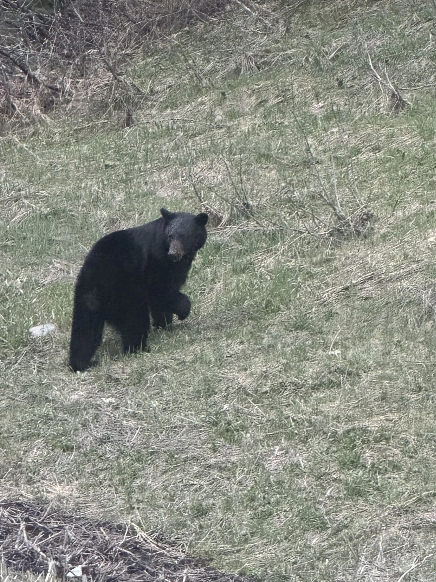
Another black bear on the Cassiar Highway driving to Alaska
Short answer: Highlights include the Fraser River Canyon (around Boston Bar), and the run from Haines Junction through Destruction Bay. Scenery really hits its stride in the Yukon and Alaska. Wildlife sightings become common — bison herds, black/brown bears, moose, and Dall sheep — so drive cautiously and don't approach animals.
Detours amplify the scenery and wildlife: Prince Rupert (nearby Khutzeymateen Grizzly Bear Sanctuary, which is awesome mid-May to late July, plus whale/bird watching), the Klondike Highway to Skagway/Haines (top-tier fishing, hiking, water sports), and Banff/Lake Louise (classic Rockies vistas, hiking, kayaking, hot springs).